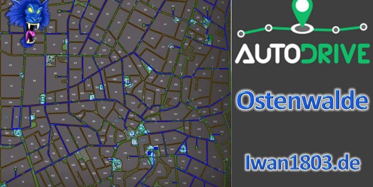
AutoDrive route network for the map “Ostenwalde” from AckerDesigner
The route network was completely driven in by me. Only the main and a few side streets were generated by AD from the splines but were partially optimized by me.
Since some of the AI traffic also travels on side streets (not dirt roads), these are defined as one-way streets. All others were provided with routes that could be used on both sides, some with alternative routes. If anything else is necessary, please add it yourself or let me know.
In addition, the destination point for field 71 is outside the field because there is no suitable departure point (fenced in by trees).
It has been tested with various vehicles, but it can of course happen that it doesn’t fit 100% in one place or another.
Please report something like this to me so that I can correct it or adapt it for yourself.
In some places the map is designed for vehicles, trailers, etc. up to a maximum of medium size. Therefore, trailers with more than 2 axles should be avoided (especially on farms).
Otherwise, even large machines can be moved quite easily and should cause virtually no problems.
The following was brought in:
– all roads, field paths and all associated intersections and junctions including right-of-way rules
– all yards including unloading and removal points, silos, stables, some parking spaces, workshops, etc.
– all fields and meadows including catch lines
– For fenced meadows and pastures there is an addition in the destination name
– all productions as well as purchasing and sales points
– Gas station
Note: The appropriate map and vehicle settings have already been saved as standard in the config. You can transfer them to existing ones using the “Restore” button.
Otherwise: Activate folder, collision height above ground to 1.25m, collision detection to “FS 19”, max. silo distance to 25m, nearest field exit
Abbreviations for the target points:
Anl. = delivery, unloading
Ent. = removal, collection
Have fun with this course!
Ivan1803

